 HurriMap
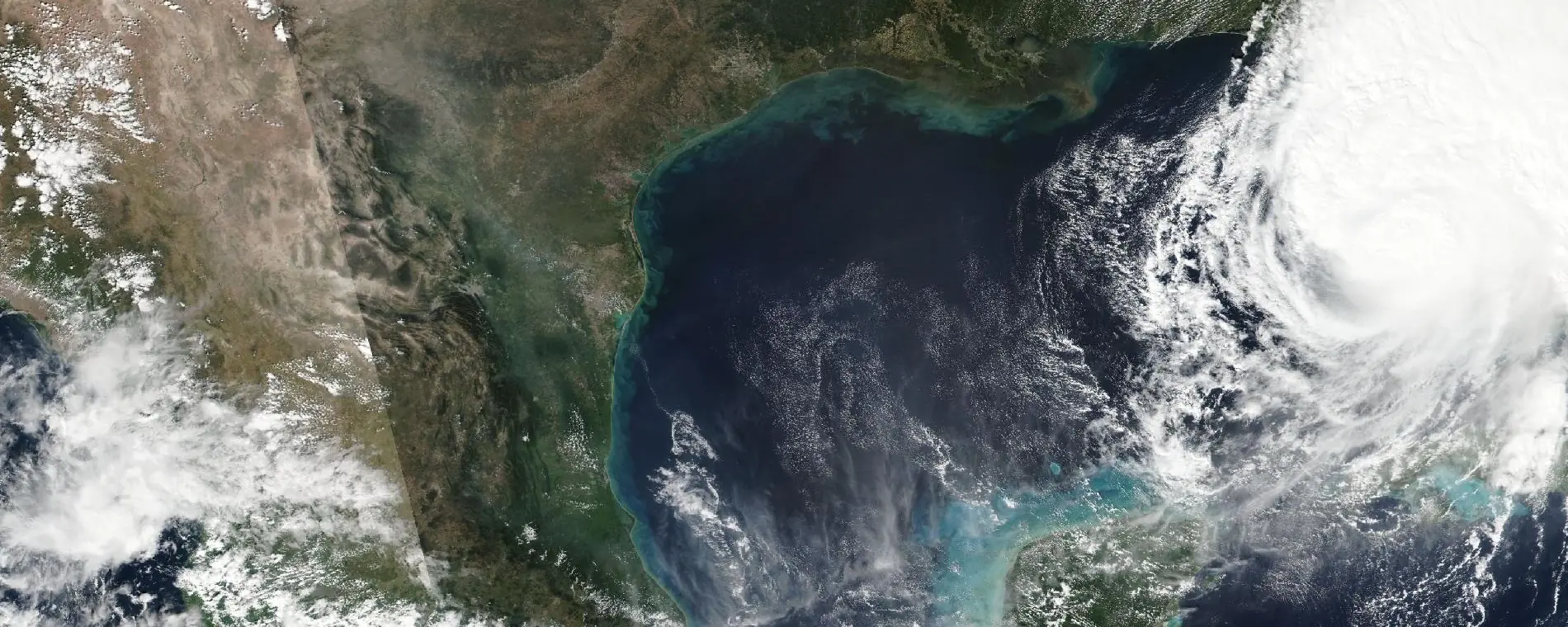
Official hurricane and typhoon forecasts, on a map built for your phone.
Cones, tracks, wind fields and watches and warnings drawn live, not pictures, from the Gulf Coast to Guam. And for your place: when the wind could arrive, when to finish preparing, and the watches and warnings issued for you.
For iPhone, iPad, Apple Watch, Android and Wear OS. Free to use, no account, no ads.
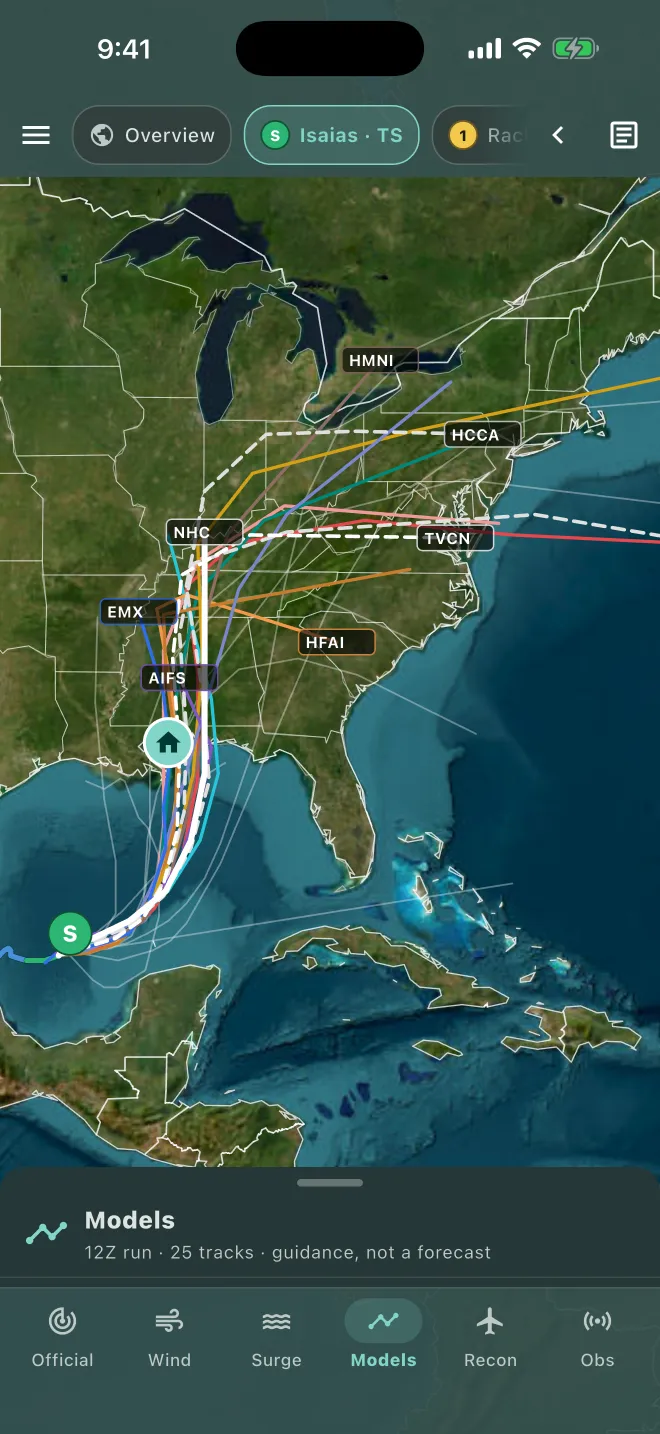
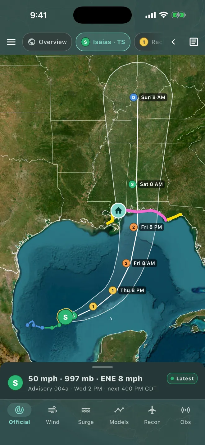
- Built on National Hurricane Center timing data
- A preparation deadline for your place
- No account needed
- No ads
The storm has a plan. You should too.
Emergency managers don't plan around the cone. They plan around time: when dangerous winds could first arrive, how long it takes to get ready, and the point after which a decision can't wait. For decades they've made those calls with professional decision support software built on the National Hurricane Center's timing forecasts. HurriMap brings that same method to your own place.
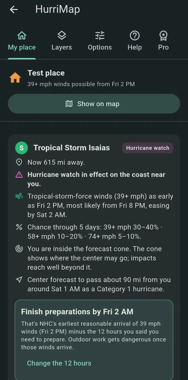
- Now. The storm is 615 miles away.
- Finish preparations by
- Earliest reasonable arrival of 39 mph winds
- Most likely arrival
- Closest approach, about 90 miles, as a Category 1
- Winds easing
Every time on this line comes from NHC's forecast for that exact spot, except one: "finish preparations by" is yours. It's the earliest reasonable arrival minus the hours you say you need. When NHC updates the forecast, the deadline moves with it.
Plans to the earliest time, not the average
NHC's earliest reasonable arrival has only about a 1-in-10 chance of being beaten. If you plan to the most likely time, the first squalls can still catch you on a ladder.
Your clearance time, not a county's
Officials work back from how long an evacuation takes. HurriMap works back from how long you need: shutters, supplies, medications, getting family where they need to be.
Tests the reasonable worst case
Shift the track toward you or make the storm stronger, and HurriMap recalculates when and how hard the wind reaches your place. Professionals plan this way.
Sees the timing across the map
The Arrival view draws labeled contours of when 39, 58 and 74 mph winds could begin, so you can see when the window closes for family, property or the route out.
One clean map instead of pages of graphics.
Tap a storm at the top. HurriMap draws NHC's official forecast as real map layers you can zoom into, with the briefing and NHC's own text one swipe away.
- Cone, track and forecast points in your local time, with coastal watches and warnings.
- Current wind field and past track, colored by strength.
- Advisory history: slide back through earlier forecasts to see how they changed.
- NHC's text, reflowed for a phone: public advisories, discussions, forecast advisories and outlooks.
- Invests and the 7-day outlook, so you see what's coming before it has a name.
- Typhoons too: storms threatening Guam, the Northern Mariana Islands and American Samoa, on the same map.
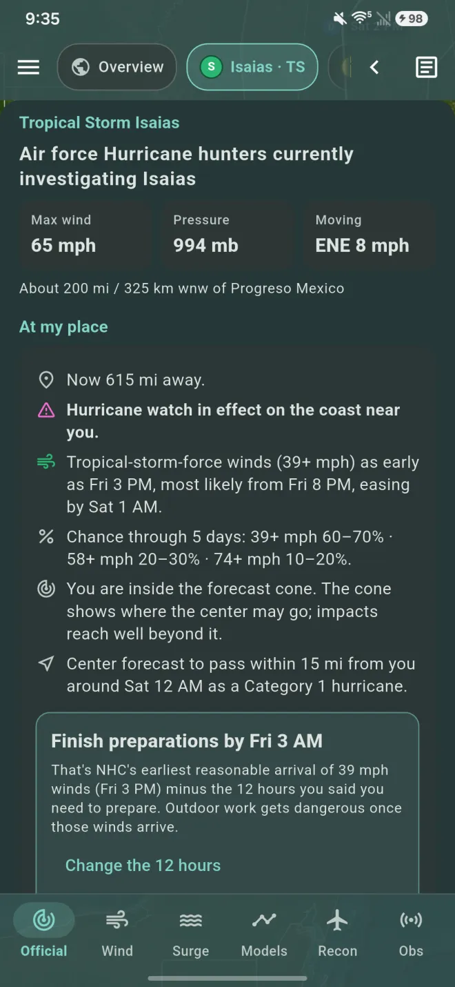
What the storm means where you are.
Set a place with a ZIP code, a press on the map, or your location. GPS is optional. HurriMap checks it against every active storm.
- When winds could arrive: NHC's earliest reasonable and most likely arrival of 39 mph winds.
- "Finish preparations by": that arrival time minus the hours you say you need.
- Your chances of 39, 58 and 74 mph winds, whether you're in the cone, and how close the center is forecast to pass.
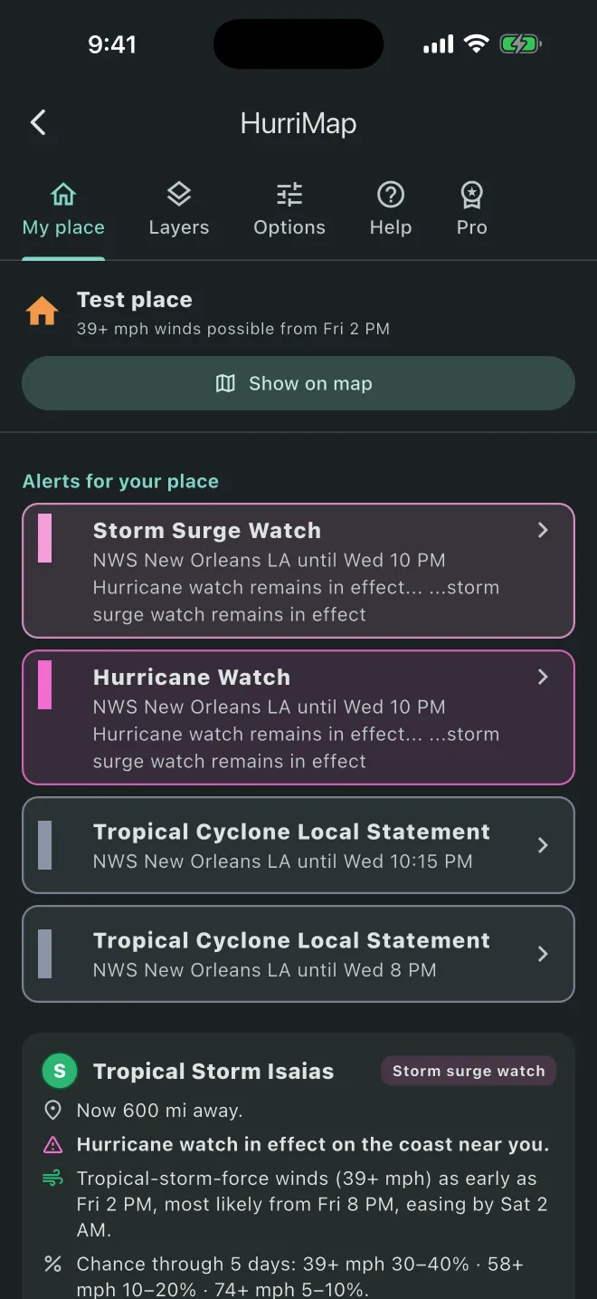
- Your NWS office's local statement, word for word and credited.
- NOAA Weather Radio stations for your county, with the SAME code for your radio.
- Florida evacuation zones and county orders, and open shelters nearby.
It won't tell you to flee the wind, or that you're safe.
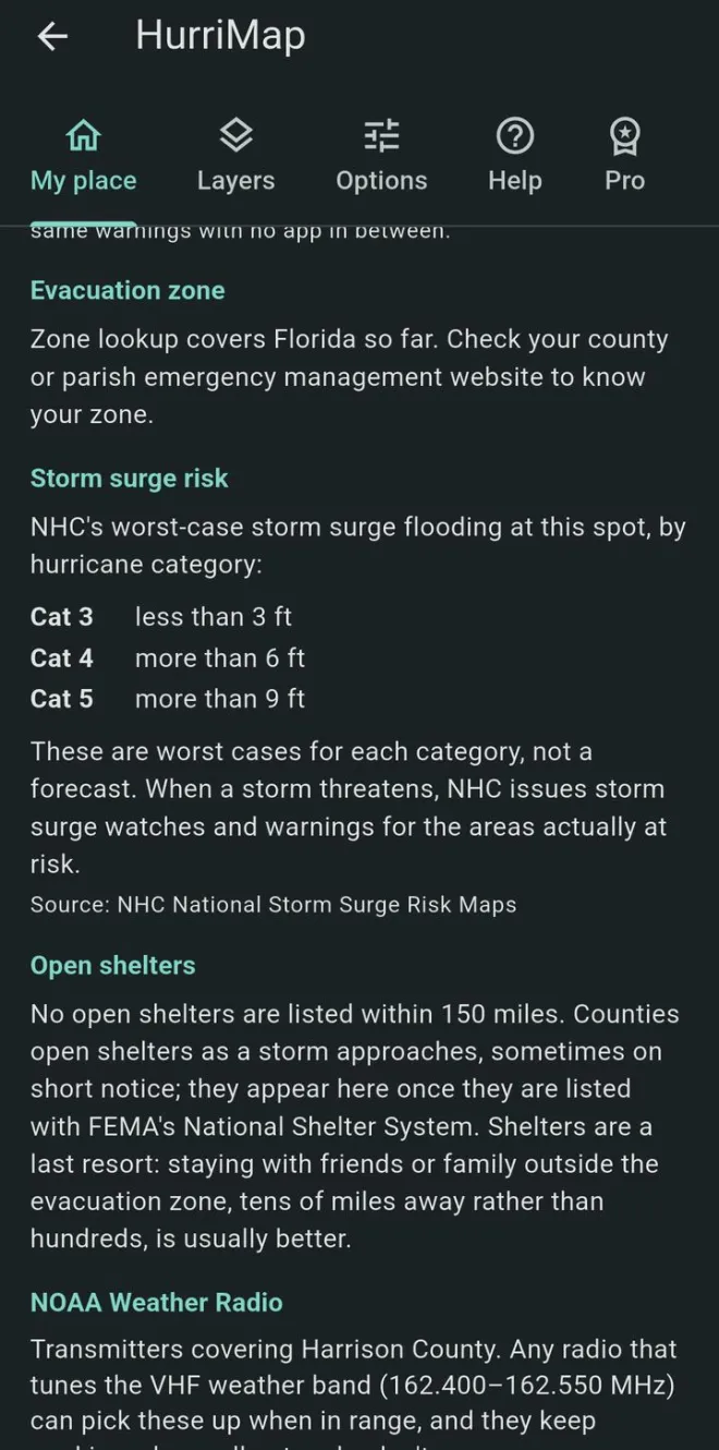
Evacuations are mainly about storm surge. Most people outside the surge zone can ride out the wind in a sturdy building. HurriMap only talks about leaving when your place is in an NHC storm surge watch or warning, or when an evacuation order is reported.
- Storm surge risk for your spot: NHC's worst-case flooding for a Category 1 through 5 hurricane, so you know if you live in surge country.
- Potential storm surge flooding when NHC issues it, in the Surge lens.
- Never a false all-clear. HurriMap doesn't tell anyone they don't need to evacuate.
The heads-up your phone doesn't get.
Wireless Emergency Alerts carry hurricane and storm surge warnings, but not watches. HurriMap tells you when a watch goes up for your place, so you have the time to get ready.
- Hurricane, tropical storm, storm surge and typhoon watches with HurriMap Pro, about 48 hours before the winds.
- Tropical storm warnings, which Wireless Emergency Alerts don't send. Free for everyone.
- Once per alert, for your place only. No marketing pushes, ever.
Keep Wireless Emergency Alerts on for the urgent warnings. HurriMap fills the gap they leave.
From the Gulf Coast to Guam.
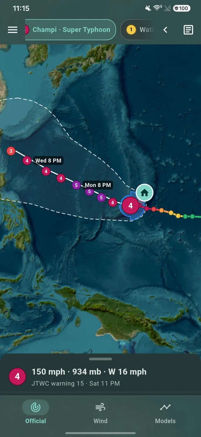
In the Pacific, Americans face typhoons, not hurricanes. HurriMap follows both: hurricanes from the National Hurricane Center, and typhoons and South Pacific cyclones from the Joint Typhoon Warning Center, side by side on one map.
- Guam, the Northern Mariana Islands and American Samoa, with Hawaii and the central Pacific covered too.
- Track, strength and wind field for every typhoon, with the danger area its winds could reach.
- Wind chances and arrival times for typhoons, built the way NHC builds them for hurricanes, so "finish preparations by" works in the Pacific too.
- Typhoon watches and warnings from the National Weather Service in Guam, on the map and in My place.
- One storm, one forecast. When two agencies track the same storm, HurriMap shows the official one for that ocean, never a confusing duplicate.
Lenses: the same storm, seen different ways.
The buttons along the bottom switch what the map shows. Each one keeps the map clear and puts its details in the panel.
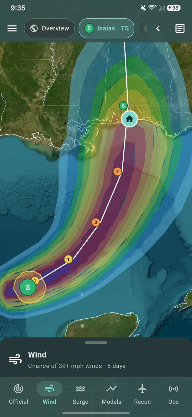
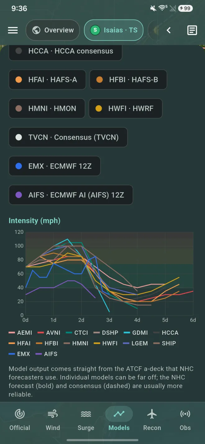
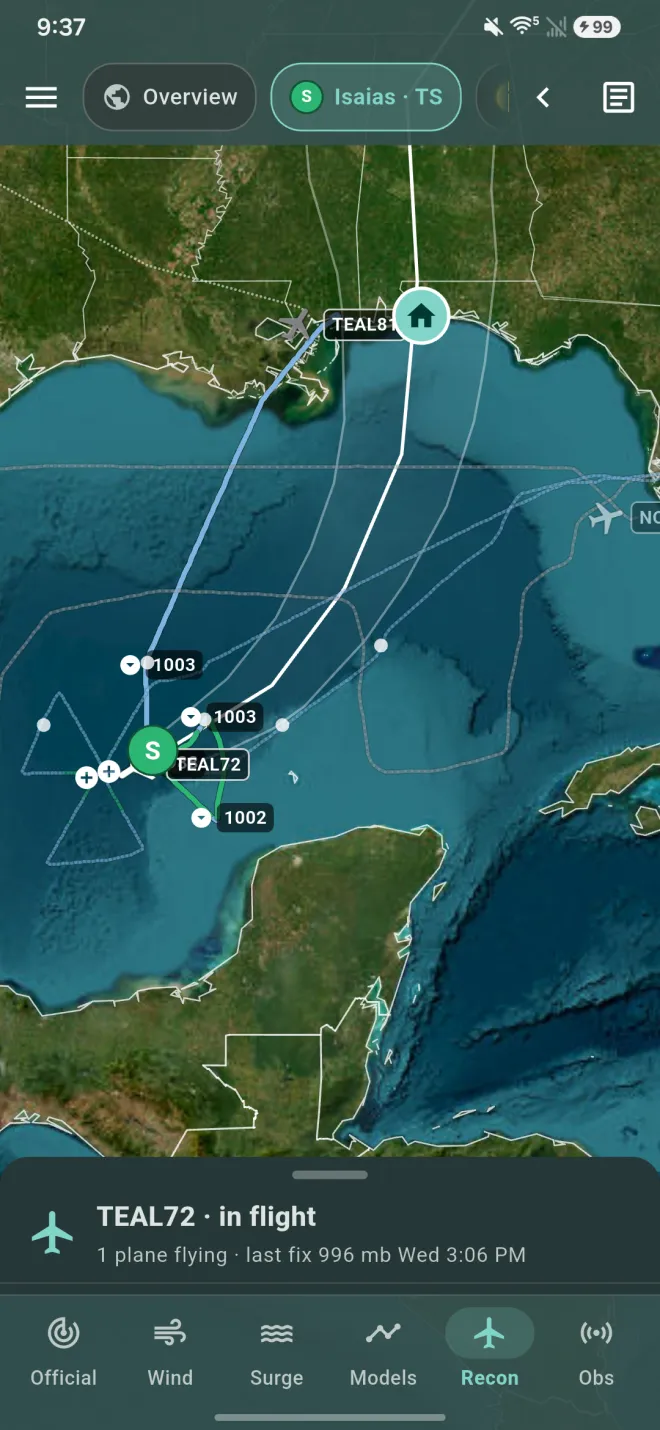
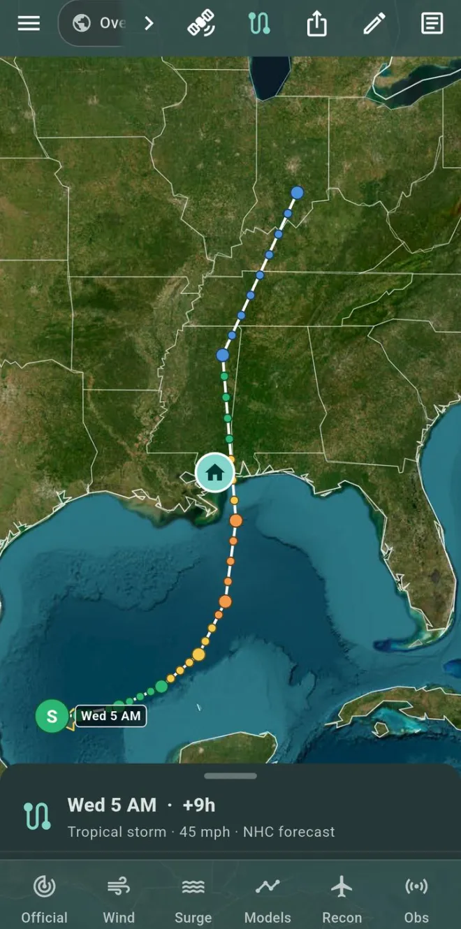
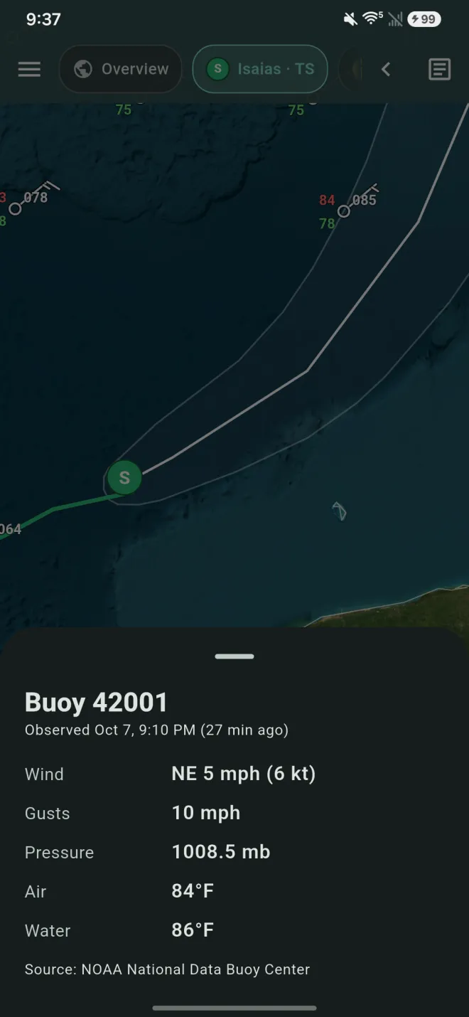
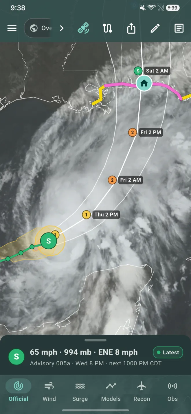
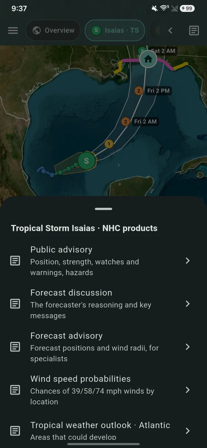
The storm that matters most, at a glance.
Apple Watch, Wear OS and home-screen widgets show the storm nearest to your place: how far away it is, any watch or warning, when the wind could arrive and when to finish preparing.
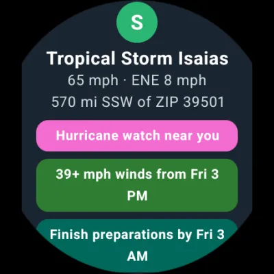
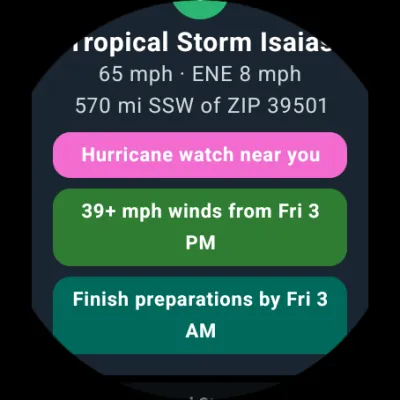
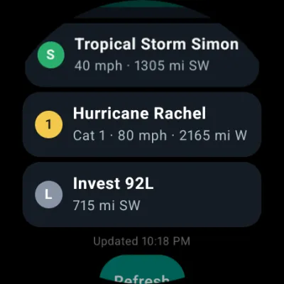
Watch apps, complications and the Wear OS tile are part of Pro. Home-screen widgets are free.
Free to use. Pro when you want more.
Everything you need to follow a storm and prepare for it is free: forecasts, watches and warnings, storm surge, wind arrival times, NHC advisories and My place. Pro adds the tools serious storm trackers want.
HurriMap
- Every active hurricane, typhoon, invest and outlook area
- Official forecast, cone, watches and warnings
- Wind probabilities and arrival times
- Storm surge lens and surge risk
- My place, with "finish preparations by"
- Tropical storm warning alerts for your place
- Buoys, satellite and NHC text products
- Step through forecast scenarios
- Home-screen widgets
HurriMap Pro
- Watch alerts: hurricane, tropical storm, storm surge and typhoon watches for your place, about 48 hours before the winds
- Models: spaghetti tracks, GEFS and ECMWF ensemble members, intensity chart
- Hurricane Hunters: live recon flights, dropsondes, vortex fixes and RECCOs
- Scenario editing: move the track and change strength to test worst cases
- Watch app: Apple Watch and Wear OS, with tile and complications
- Draw on maps before you share them
Subscribe in the app through the App Store or Google Play. Cancel anytime in your store account.
The same forecasts emergency managers plan around. Made personal.
HurriMap takes the official forecasts for every ocean that threatens Americans and turns them into a deadline for your own place: when the wind could arrive, and when you need to be ready.
National Hurricane Center
The official cone, track, intensity, wind arrival times and storm surge risk.
Joint Typhoon Warning Center
Official typhoon and cyclone forecasts for the western and South Pacific.
National Weather Service
Watches, warnings and local statements for your place, from the Gulf Coast to Guam.
Weather Prediction Center
Rainfall and flash flood outlooks.
GOES-East and GOES-West
Live satellite imagery.
Hurricane Hunters
Live reconnaissance from inside the storm.
National Data Buoy Center
Buoy and coastal observations.
National Shelter System
Open shelters near you.
Division of Emergency Management
County evacuation orders.
European Centre for Medium-Range Weather Forecasts
European model guidance. © ECMWF, CC BY 4.0.

Be ready before the wind arrives.
Get HurriMap for iPhone, iPad, Apple Watch, Android and Wear OS.